logo info-neige

INFO-Neige Montreal Snow Removal App

Helping Montreal Drivers Know Where to Park Before the Snowplows Arrive

Driver viewing a mobile app with real-time snow removal routes and city map data displayed on a smartphone in a car

Categories

Smart City & GIS

Technologies used

iOS | Android | Web App | .NET on Azure

About The Client

The City of Montréal is Quebec’s largest municipality, and its boroughs share responsibility for winter operations on their streets. Each winter, the City runs several snow loading operations, and every one of them brings temporary parking bans, street by street. To keep residents informed, the City publishes its snow loading data on its open data portal and relies on apps like INFO-Neige* to get that information into drivers’ hands.

*The partnership ended in 2026.

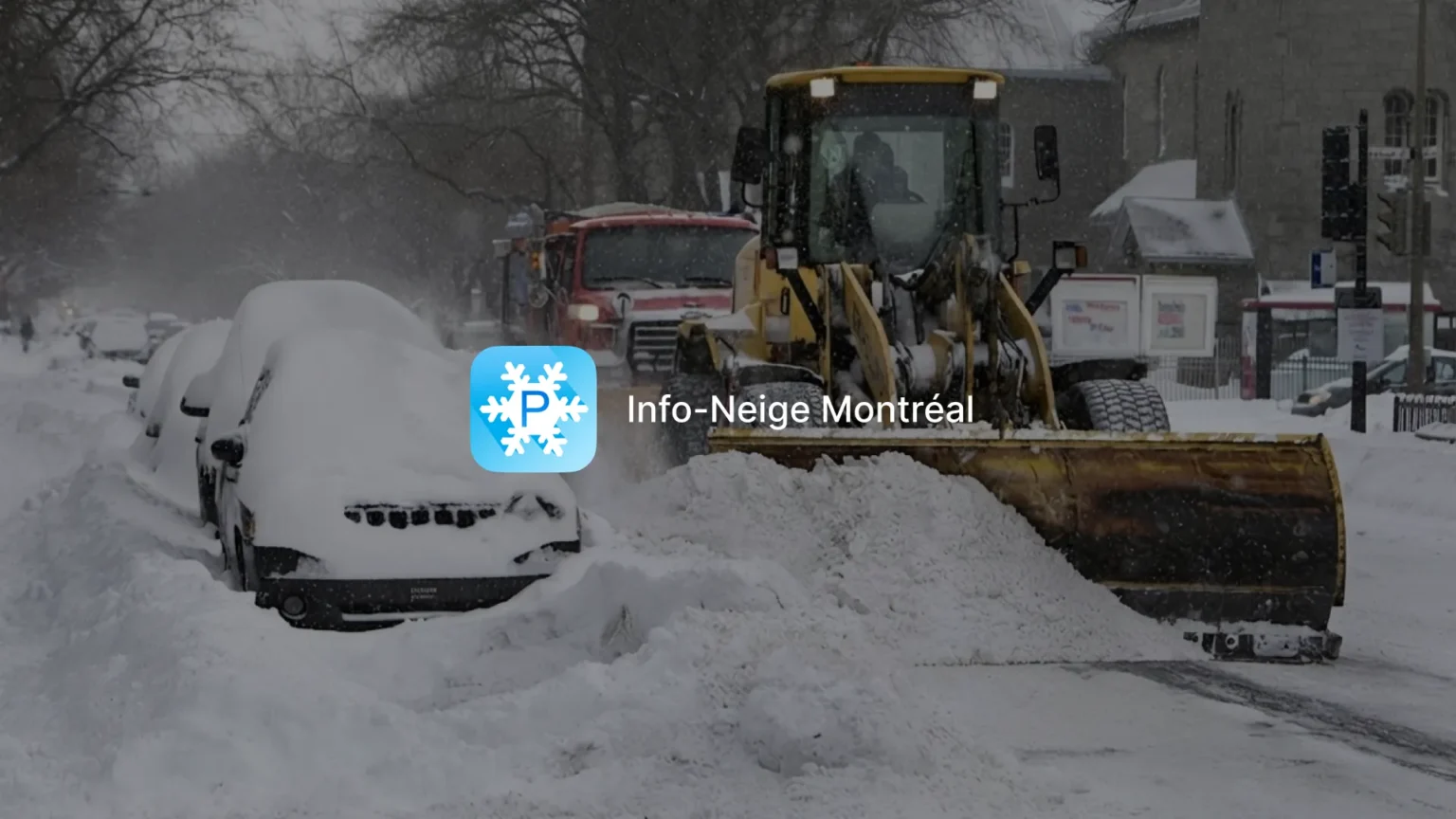
INFO-Neige Montréal app icon over a snow loading operation, with a loader clearing a street lined with snow-covered cars

Project Overview

The Project

The City wanted a mobile app that would tell drivers, clearly and in real time, when their street was about to be cleared. To find it, the City organized a public hackathon, and nearly 80 developers and agencies took part. Sidekick Interactive won first prize with INFO-Neige, a Montreal snow removal app built entirely on the City’s open data.

Over the following winters, our team maintained the app and kept adding features, across iOS, Android and the web.

The Context

During a loading operation, parked cars get in the way of snowplows and trucks. The City has to tow them to keep the work moving, which slows the operation down and leaves plenty of drivers with a ticket and a car that is no longer where they left it. Many of those tows could be avoided if drivers learned in time that the ban covered their street.

Snow loading data comes directly from Planif-Neige, the City’s centralized snow removal management system, and is supplied by the participating boroughs. Drivers needed a way to read it at street level, on their phone, when deciding where to park.

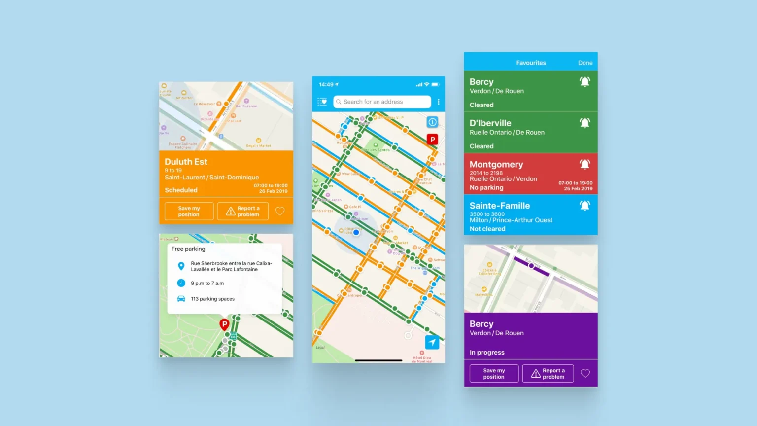
INFO-Neige app components showing a color-coded street map, a scheduled loading card, free parking details and favourite streets by snow removal status

Challenges and Technical Constraints for a Montreal Snow Removal App

The Challenge

We had to turn municipal data into something a driver can understand in a few seconds, standing outside in a snowstorm, and tell them whether they can leave their car on that street tonight. The app also had to stay fast on the nights an operation starts, when usage spikes all at once.

Constraints

Real-time sync with Planif-Neige data, published by the City and updated by each participating borough

An interface usable outdoors, in bad weather, with no learning curve

Alerts delivered by push notification, SMS and email

iOS, Android and web apps running on a single back-end

Sharp traffic peaks every time a loading operation begins

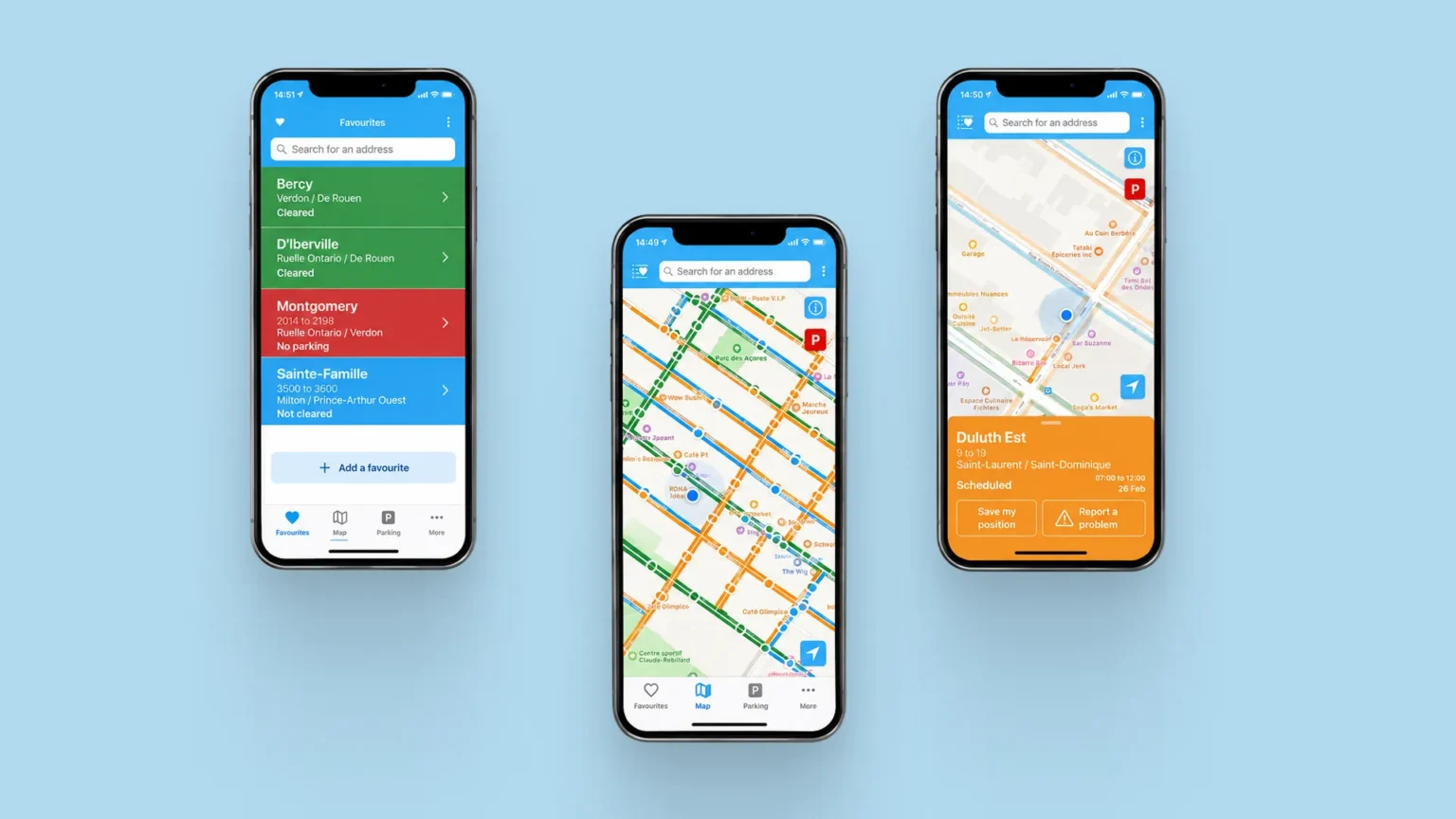
Three INFO-Neige app screens showing favourite streets by status, a color-coded snow removal map and a scheduled loading card for Duluth Est

Our Approach and Solution for Real-Time Snow Removal Tracking

A Driver-First Design That Won the City's Hackathon

We designed INFO-Neige around how a driver uses it, outdoors and often in a hurry, so each view shows as little as possible. On the map, every street segment carries a color that matches its status (cleared, scheduled, in progress, not cleared, no parking), so a quick look is enough to know where things stand. Our UX/UI design team cut everything else, and that uncluttered approach is what won the jury over.

Snow Loading Data Straight From Planif-Neige

The app connects to the City’s open data, fed by Planif-Neige. When a borough updates the status of a street, the change shows up in INFO-Neige. Users can locate themselves on the map, search for an address, and check the loading window planned for each street segment, with start and end times.

Street-by-Street Alerts by Push, SMS and Email

Drivers can save the places they care about: home, the office, the street where they parked last night. When the status of a saved street changes, INFO-Neige sends an alert by push notification, SMS or email, depending on the user’s settings. SMS and email are sent through Twilio.

One Platform Behind the Mobile and Web Apps

The mobile apps are native, written in Swift for iOS and Kotlin for Android, which keeps the map smooth even on mid-range phones. The web application is built with Angular. All three rely on a .NET back-end hosted on Azure, as part of Sidekick’s INFO-Neige platform. 

Maintenance and New Features, Winter After Winter

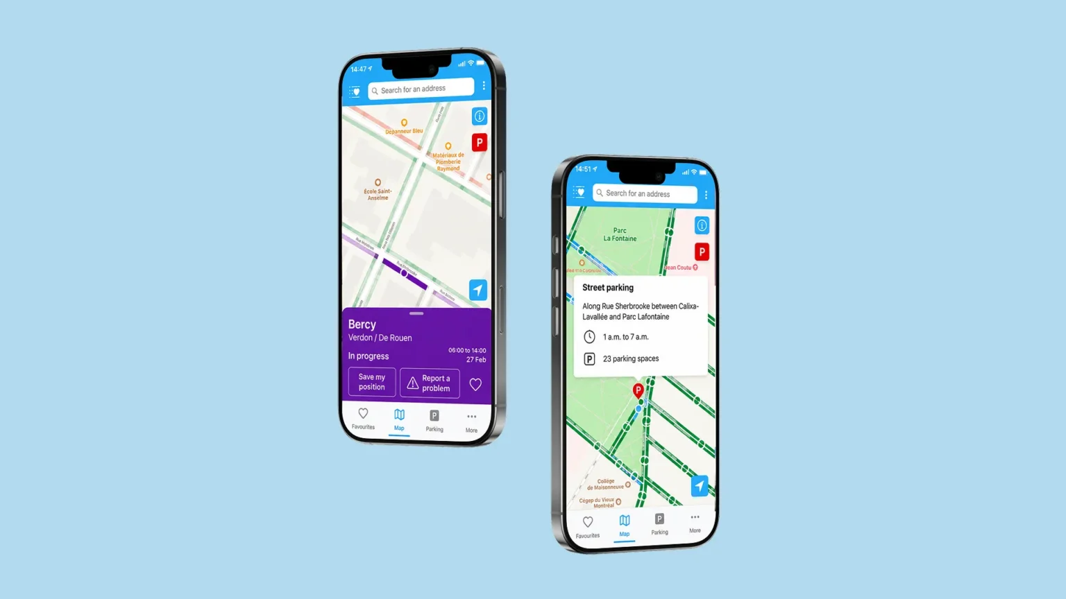
Our mobile app maintenance work kept the snow removal app in step with new iOS and Android versions while the product kept evolving. Since the winter of 2019, users can report poorly cleared places directly from the app. They can also find the free parking lots the City opens during operations, with the address, hours and number of spaces available.

Two INFO-Neige app screens showing a street with snow loading in progress and a street parking option on Rue Sherbrooke with hours and available spaces

Results and Benefits for Montreal Drivers

Results

INFO-Neige gives Montreal drivers a simple way to check a street before parking, instead of finding out the next morning. Compared to a basic snow clearing app, it combines live data from the City, alerts on saved streets and a map built for quick reading.

downloads
+ 500 k

in about ten years, across iOS and Android

prize at the City's hackathon
1 st

out of nearly 80 developers and agencies who took part in the competition

INFO-Neige MTL is available on the App Store and Google Play.

Why the City of Montréal Chose Sidekick Interactive for Its Snow Removal App

The City selected INFO-Neige through an open competition, where the jury compared working products and kept the one that made snow loading data easiest to understand. Sidekick Interactive then stayed on for years of maintenance and new features. Laval, Terrebonne and Westmount later came to Sidekick for their own snow removal and parking apps.

Sidekick Interactive's Expertise in Smart City and GIS Apps

INFO-Neige is one of the projects behind our GIS app development work, and a good example of what government app development asks of a team. Public-facing city apps come with their own set of requirements: live data from systems we don’t control, dense map layers, sudden spikes in usage, and users who expect answers right away.

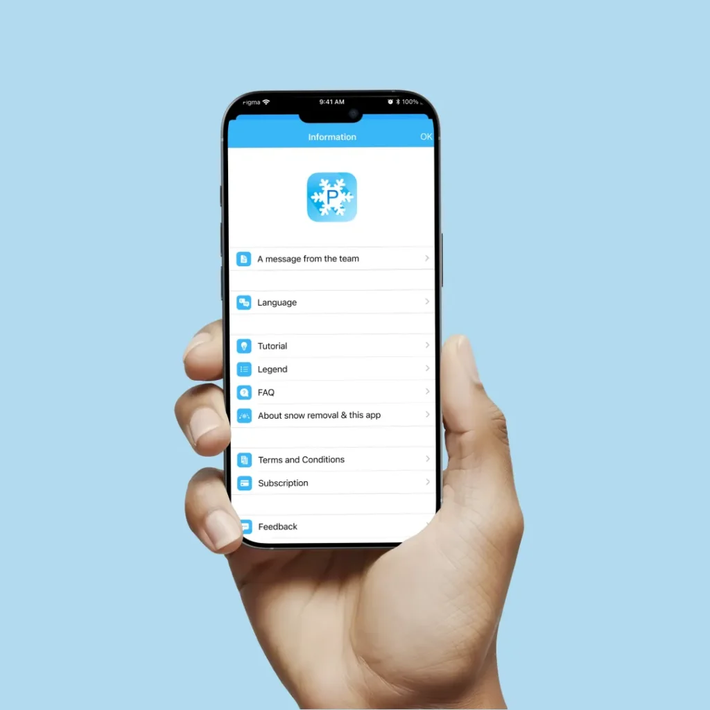
Hand holding a phone showing the INFO-Neige app information menu with tutorial, legend, FAQ and feedback options

Other Projects

Mobile app displaying geospatial data and asset details used for field data collection and public works monitoring

JMap Survey Field Data Collection App

User interacting with an augmented reality interface to visualize a sofa in a real living space before purchase

Virtual Furniture Placement

Let's talk about your 
idea.
project.
application.
Scroll to Top
Sidekick Interactive
Privacy Overview

This website uses cookies so that we can provide you with the best user experience possible. Cookie information is stored in your browser and performs functions such as recognising you when you return to our website and helping our team to understand which sections of the website you find most interesting and useful.