jmap survey icon

JMap Survey Field Data Collection App for Public Works

Bringing Custom GIS Maps to Field Crews, With or Without a Network

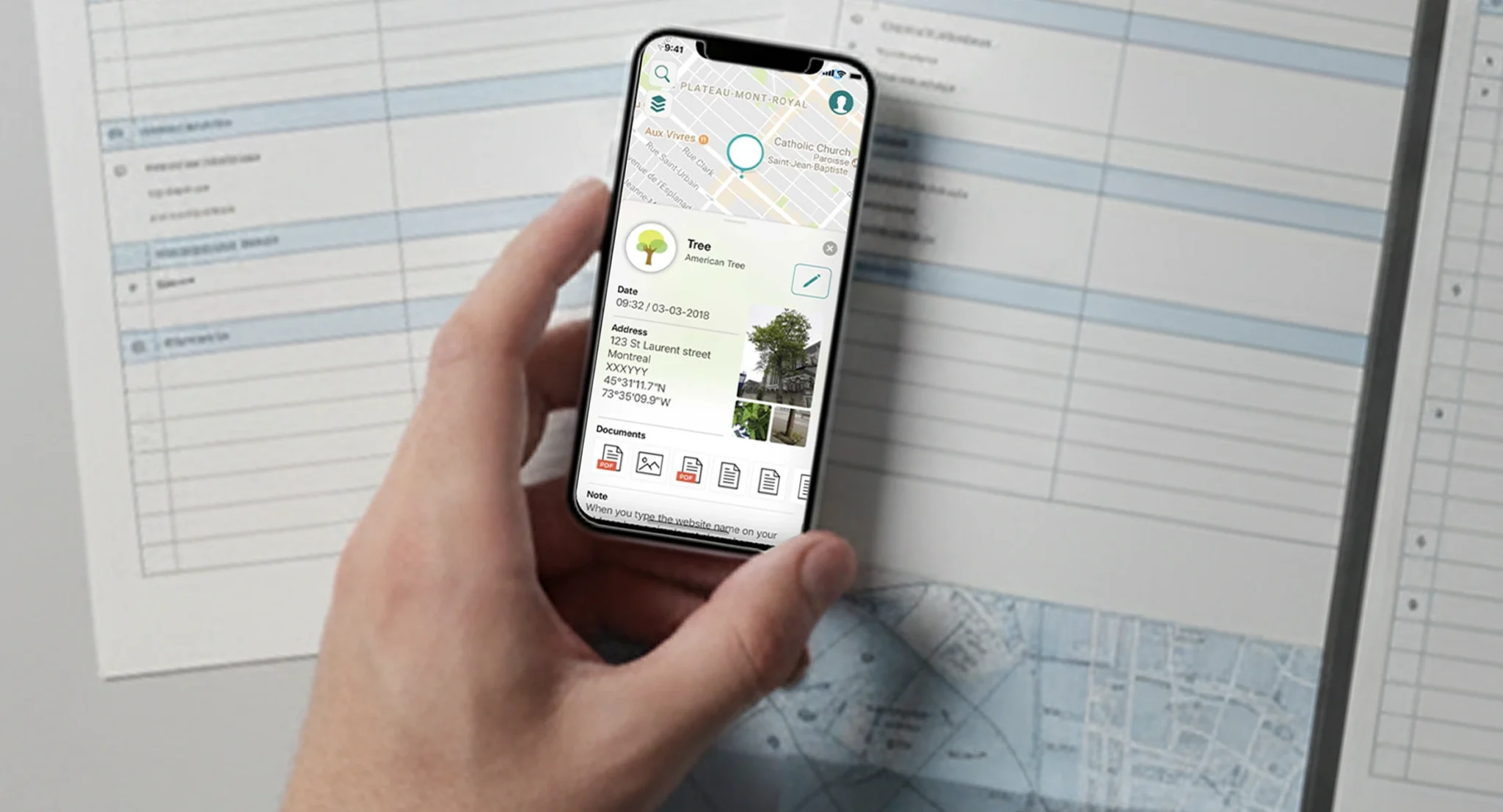
Mobile app displaying geospatial data and asset details used for field data collection and public works monitoring

Categories

Smart City & GIS

Technologies used

iOS | Android | Mapbox SDK | GeoJSON | JMap Server integration

About The Client

K2 Geospatial is a Montreal company that develops JMap, a map-based integration platform that brings an organization’s systems and data together on one map. Since 1995, it has built tools that make spatial information usable by people who aren’t GIS specialists. Its clients are mainly cities and municipalities, who manage their geospatial data with JMap Server, JMap Admin and JMap Documents.

JMap Survey logo centered on a light background with a teal wave at the bottom

Project Overview

The Project

K2 Geospatial wanted to take JMap into the field. The goal was a native field data collection app for iOS and Android, on smartphones and tablets, connected directly to JMap Server. With JMap Survey, crews open their organization’s projects on site and enter their data in the field.

The Context

On public contracts, the foreman has to keep up with all the work happening across the city. They make sure contractors deliver on time and apply the penalties set out in the contract when deadlines slip. K2 Geospatial needed a field data collection app to monitor the progress of these contracts that everyone involved could use on site, even without network coverage.

Challenges and Technical Constraints for a Field Data Collection App

The Challenge

The biggest piece of work was displaying JMap’s custom maps inside a native mobile app and letting users interact with them. On earlier projects, our team had often relied on Apple Maps and Google Maps, which offer smooth and fast rendering. To go as far as K2 Geospatial expected, the app needed a different mapping engine, without giving up that fluidity.

Constraints

Display custom JMap maps in a native app and let users interact with them

Connect to JMap Server and use the projects and layers each organization has already set up

Keep working with or without a network connection

Use the forms created in JMap Admin without any modification

Run on iOS and Android, on smartphones and tablets

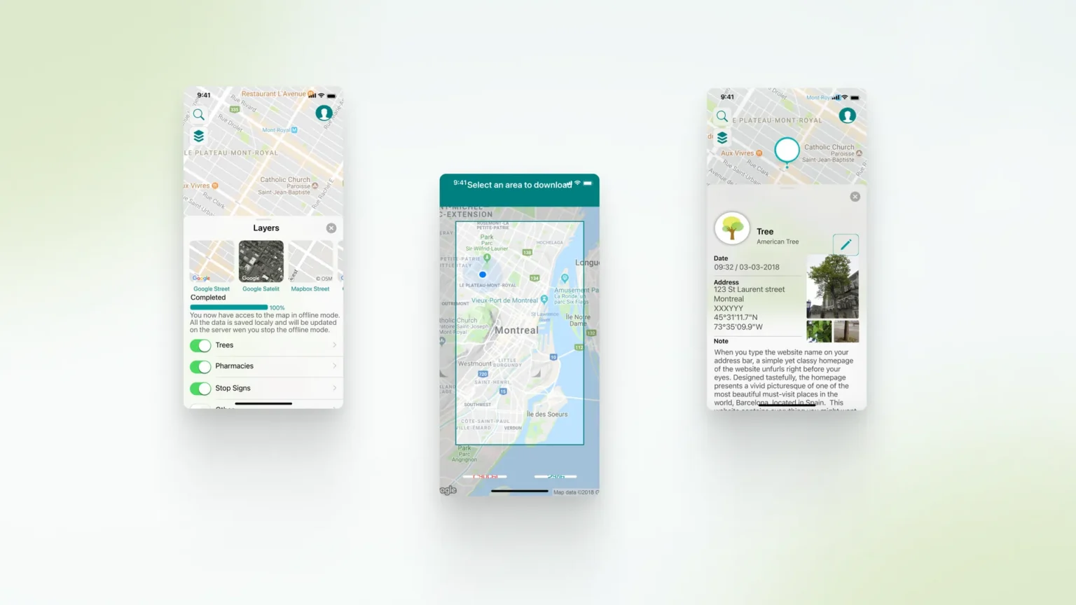
Three JMap Survey screens: base map and layer selection with offline download completed, map area selection for offline use, and a tree detail card with

Our Approach and Solution for Mobile GIS in the Field

Custom Maps Rendered With the Mapbox SDK

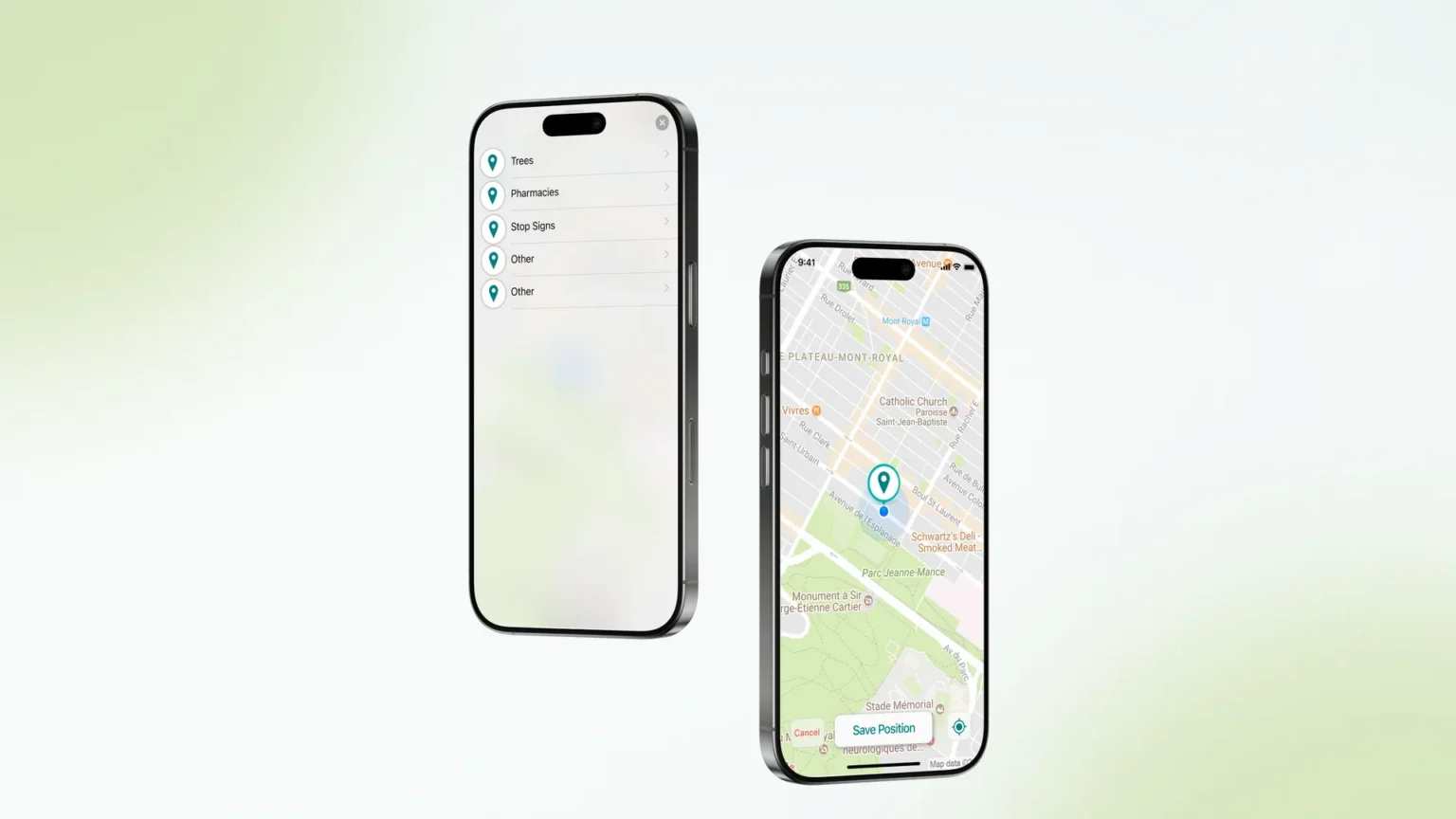
We built the map experience on the Mapbox SDK and GeoJSON. This gave our team the control needed to display each organization’s layers the way they are configured in JMap. From the map, crews query any layer and open an object to see its attributes and attached documents.

Working Online or Offline on the Worksite

JMap Survey works in both connected and disconnected modes, so crews can keep viewing maps and entering data when the signal drops. Every person involved can access the project from anywhere.

Forms That Follow the JMap Layers

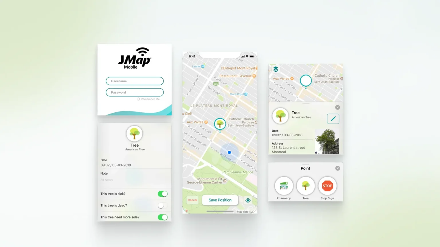
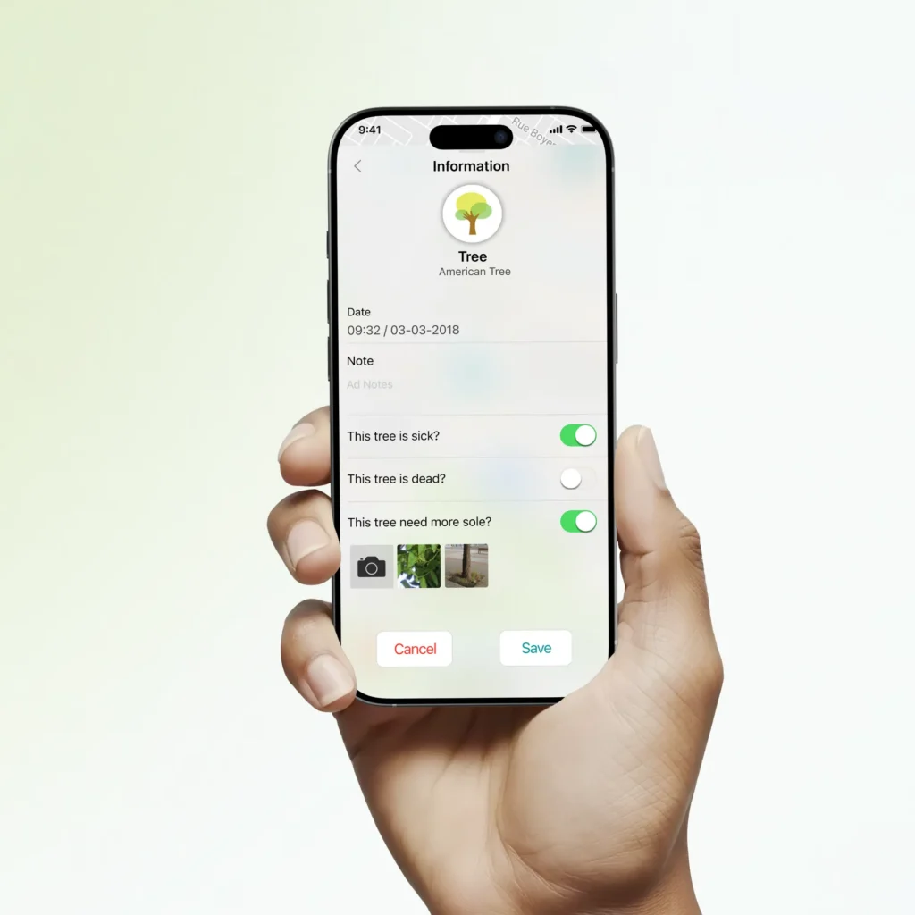
Each organization creates its objects and forms in JMap Admin, tied to its map layers. JMap Survey uses them as they are, with all their components, so nothing has to be rebuilt on the mobile side. A crew recording a street tree, for example, fills in its species, height and condition, adds photos during data entry, and positions it with the device’s GPS or a paired external GPS.

Native Apps for Smartphones and Tablets

The app was developed natively, in Swift for iOS and Kotlin for Android, and runs on iPhone, iPad and Android devices. It makes data entry simpler for foremen in the field.

Two phones showing the JMap Survey layer list (trees, pharmacies, stop signs) and a map view to save a new point’s position

Results and Benefits for Public Works Monitoring

Results

JMap Survey is live on the App Store and Google Play. Foremen and field crews enter their data directly on site. For K2 Geospatial, the field data collection app extends JMap to mobile without changing how organizations configure their projects.

App Store rating
1 /5

awarded by users who reviewed JMap Survey on iPhone and iPad

downloads on Google Play
1 +

recorded for an app that requires a JMap Server license

Why K2 Geospatial Chose Sidekick Interactive for Its Field Data Collection App

Sidekick Interactive delivered JMap Survey natively on iOS and Android. To go as far as K2 Geospatial expected, our team set Apple Maps and Google Maps aside and built the custom maps on the Mapbox SDK.

Sidekick Interactive's Expertise in Logistics App Development

This project reflects our work in logistics app development, for carriers and for the partners who handle their parcels. The same skills apply to courier app development and parcel delivery app development, where a mobile interface has to connect to a carrier’s systems and to its partners’ platforms, for people who rarely work at a desk. Because the app runs at a store counter, the project also called for a retail app development mindset, with a flow that keeps up with the pace of a checkout.

We regularly build custom workflow apps for frontline teams and work with enterprise clients whose projects cross organizational boundaries they don’t control. When the goal is to validate an idea before a larger investment, our POC app development approach relies on a small senior team and a scope limited to what the decision depends on.

Hand holding a phone showing a JMap Survey tree inspection form with notes, condition toggles and photos

Other Projects

User holding a mobile app in a city park showing local points of interest and outdoor activity tracking features

Parcourir Laval Interactive Tourism App

User interacting with a mobile app displaying real-time home security alerts and wireless sensor data

Aerial IoT Home Security App

Let's talk about your 
idea.
project.
application.
Scroll to Top
Sidekick Interactive
Privacy Overview

This website uses cookies so that we can provide you with the best user experience possible. Cookie information is stored in your browser and performs functions such as recognising you when you return to our website and helping our team to understand which sections of the website you find most interesting and useful.